
Review · DRONE PHOTOGRAPHY
Hanksville/Torrey: Bentonite Hills Drone/Photography Tour
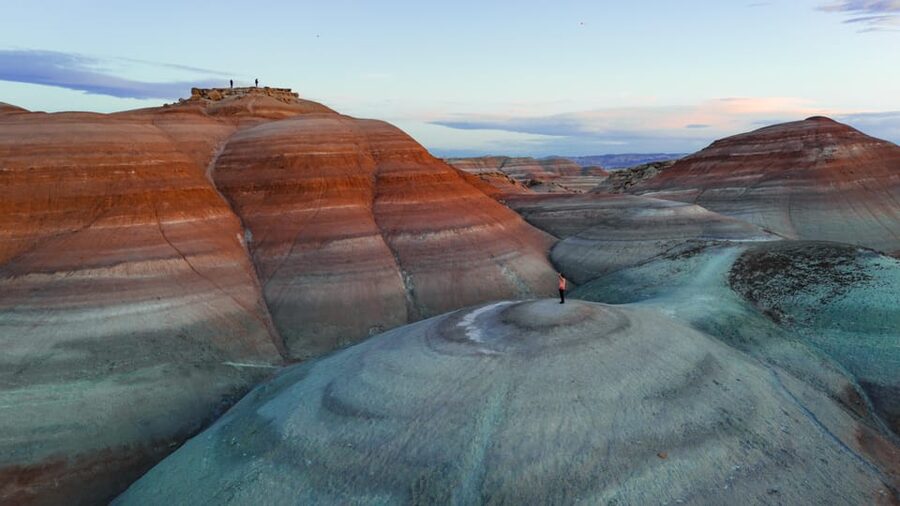
Mars begins in southern Utah. This private, three-hour Bentonite Hills photography tour takes you across red and blue clay formations near Hanksville and NASA’s Mars research facility. I like the chance to reach striking photo locations by off-road vehicle, and I like that guides such as Jenny add geology, local history, and practical advice rather than simply pointing at the scenery. The main drawback is the climb: the best viewpoints require about 50 to 100 feet of uphill walking, so this is not a good fit for anyone with limited mobility or low fitness.
At $180 per person, the tour is not a cheap scenic drive, but the price includes pickup, transportation, a private guide, and water. I also like the flexibility of free cancellation up to 24 hours before departure and the option to reserve without paying immediately. Bring proper shoes, and keep your plans loose because weather and rough ground can force changes.
Key points to know before you go
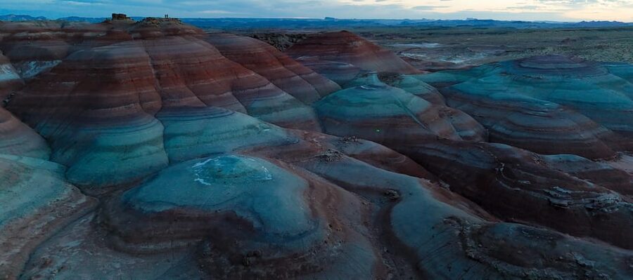
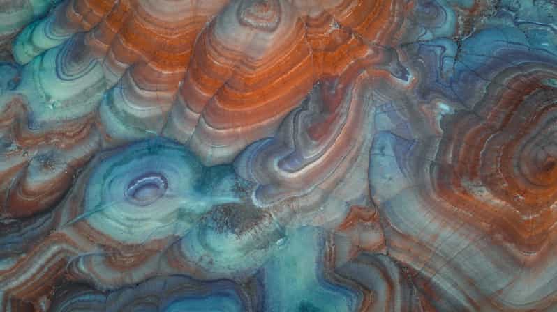
- The colors are the main event: Red, pink, gray, and blue bentonite clay create strange striped patterns that look unlike most of Utah’s better-known parks.
- You get a private group: Your guide can focus on your photography interests instead of following a large bus group.
- Jenny receives especially strong praise: Her geological explanations, local suggestions, and ability to find less obvious bentonite formations add real value.
- The tour is built for photographers: You can work on composition and aerial images, while drone video is available as an add-on.
- A short climb is still required: Reaching the finest viewpoints means climbing approximately 50 to 100 feet over uneven ground.
- Pickup covers three nearby communities: Complimentary pickup is available in Hanksville, Torrey, and Teasdale.
Why the Bentonite Hills look like another planet
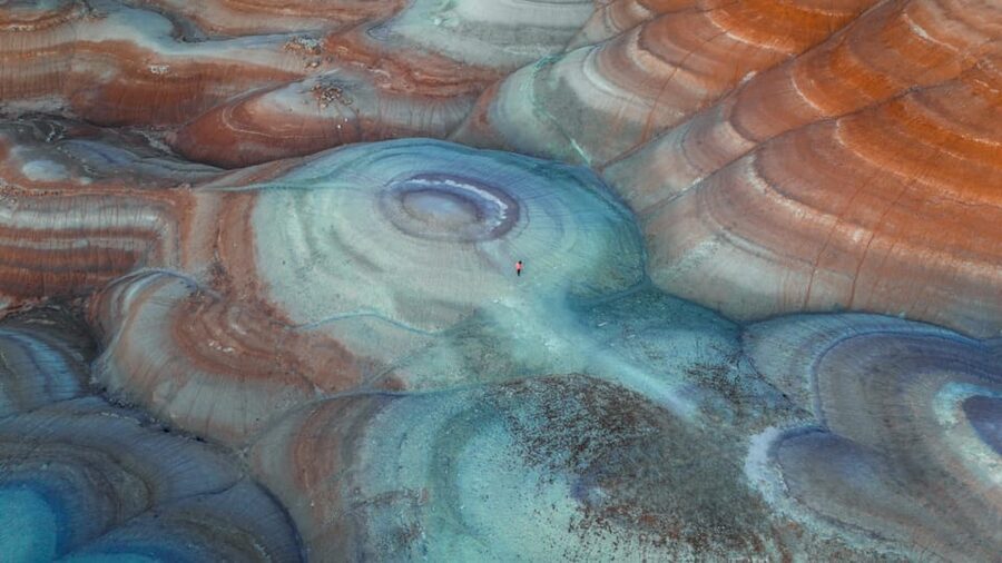
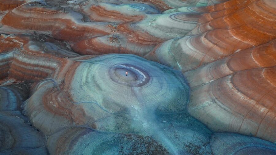
Bentonite is a soft clay formed from volcanic ash. In this part of Utah, layers of clay weather into rounded ridges and folded bands of color. The result is a broad sweep of red, rust, tan, gray, and blue tones with very little vegetation to soften the view.
That combination gives the hills their Mars-like appearance. The nearby NASA research facility adds to the mood, since this area is used for work connected to desert exploration and Mars simulations. You are not visiting a theme park or a constructed attraction. You are seeing a real geological setting that helps explain why scientists use harsh Utah terrain to think about other worlds.
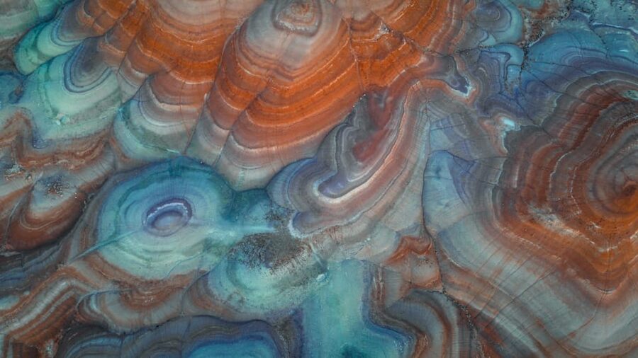
I find the color patterns more interesting than a simple red-rock viewpoint. Light changes the clay quickly, and even a small shift in position can reveal a new curve, ridge, or stripe. That makes the area useful for photographers who want more than a single postcard view.
The soft clay also deserves respect. It can be damaged by foot traffic and vehicles, and wet weather can make it difficult or unsafe to cross. Your guide decides how far the vehicle and group can go based on current conditions.
More Photography Tours in the USA
- From Waikiki: Best of Oahu Photo Tour with Pickup
★ 4.9 · 274 reviews - The Ultimate LA and Hollywood Photo Tour
★ 5.0 · 233 reviews - Beautiful Colors of Hawaii Photo Tour
★ 5.0 · 165 reviews
Pickup in Hanksville, Torrey, or Teasdale
The tour includes pickup and drop-off in Hanksville, Torrey, and Teasdale. Look for a black or white SUV marked with Meridian lettering. That detail matters in small desert communities, where several vehicles may be waiting near a hotel or meeting point.
Transportation is included, so you do not need to arrange your own off-road vehicle. This is useful if you are visiting the area in a regular rental car and do not want to risk its tires or suspension on rough trails. It also means your guide handles the route while you watch for photo opportunities.
The exact starting time depends on availability. Since the outing lasts three hours, allow extra time around it for reaching your pickup point, eating, and dealing with changing weather. Hanksville is the most natural base for the tour, while Torrey and Teasdale make sense if you are staying near Capitol Reef.
The private format is worth noting. You are not sharing the outing with a large mixed group, so the pace can better suit photography. If you need extra time to frame a shot, ask a question about the clay, or compare several viewpoints, a private group gives you more room to do that.
Off-road trails through the red and blue clay
Once you leave the pickup point, the tour heads toward the Bentonite Hills by vehicle. The route follows rocky desert tracks, and the ride is part of the experience. You are moving beyond the easiest roadside viewpoints and into areas where the folded clay formations fill your view.
I would think of the drive as access rather than a separate sightseeing attraction. The real reward comes when the guide stops at places where the ridges and color bands are most useful for photographs. Terrain conditions determine how far the vehicle can go, so the route may change from one day to another.
At the stops, your guide can help you read the shapes of the hills and understand the forces that formed them. Jenny has been praised for explaining the area from a geological point of view, which is especially helpful if you see many similar-looking ridges and want to understand what makes each one different.
The experience is not built around a long list of formal attractions. Instead, it gives you time in a striking setting, with someone who knows where the formations are most photogenic. That approach works well for people who prefer a focused outdoor outing over a packed sightseeing schedule.
Finding the best viewpoints on foot
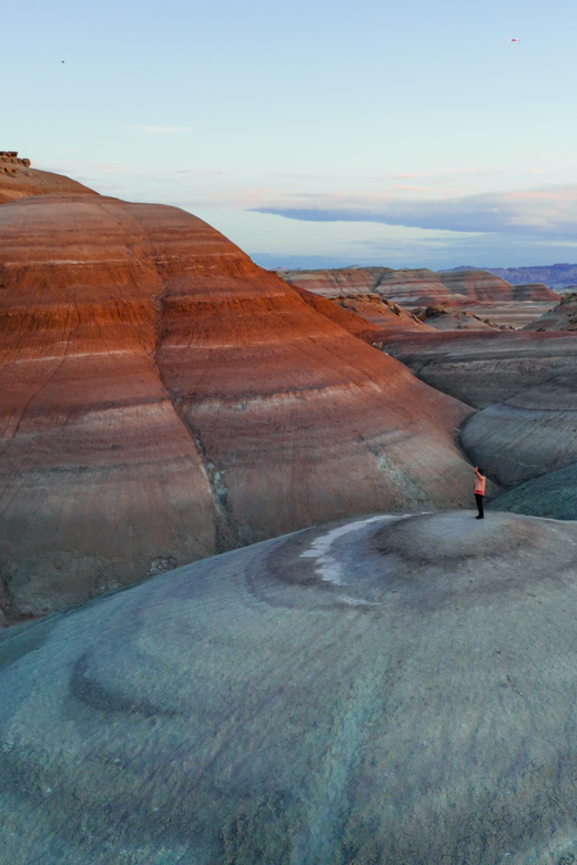
The most important physical detail is the climb. To reach the best vantage points, you may need to walk uphill approximately 50 to 100 feet over rough ground. That distance may sound modest, but loose clay, rocks, and uneven surfaces can make it feel more demanding than a normal paved trail.
Closed-toe shoes are required. I would choose sturdy footwear with good grip rather than sandals or smooth-soled casual shoes. Water is provided, but you should still arrive ready for sun, heat, and dry desert conditions.
The tour is specifically not suitable for people with mobility impairments, people over 60, or people with a low level of fitness. That policy is blunt, but the underlying issue is clear: the outing includes uneven terrain and uphill walking. Age alone does not tell you how difficult the tour will feel, but the stated limits should be taken seriously when deciding.
If you are comfortable walking on rocky ground and climbing a short slope, the effort has a clear payoff. Higher positions let you see the bentonite bands as broad patterns rather than isolated lumps. They also give you more control over foreground, middle ground, and sky in your photographs.
Same place, a different kind of shoot:
- The ‘OG’ Manatee Snorkel Tour with In-Water Guide/Photographer
★ 5.0 · 2,539 reviews - Manatee Swim Tour with In Water Photographer
★ 5.0 · 2,300 reviews - Guided Small Group Manatee Snorkeling Tour with In-Water Photographer
★ 5.0 · 1,336 reviews - LA: Hollywood Sign Tour with Comedians, Dogs, & Epic Photos
★ 4.9 · 1,193 reviews
Making the most of the photography time
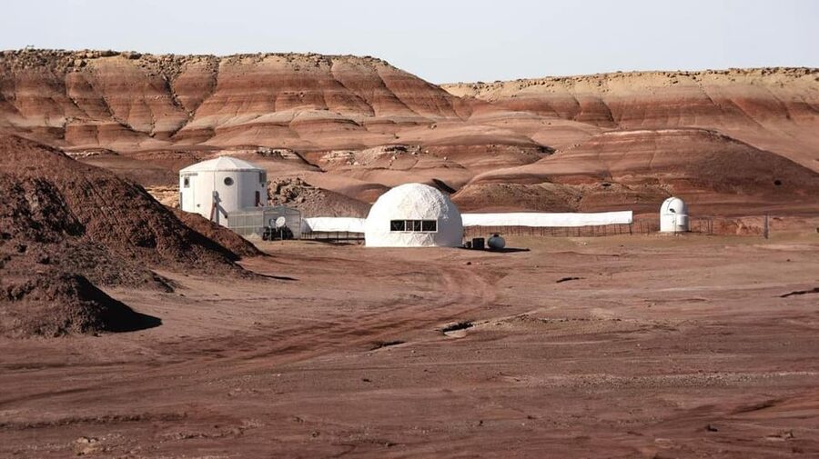
The tour suits experienced photographers, but you do not need advanced skills to enjoy it. The unusual colors and shapes give beginners plenty to work with. You can practice leading lines, contrasting curves, close-up texture, and wide views without needing a complicated plan.
Bring the camera or phone you actually enjoy using. A better device helps, but the guide and setting do much of the work. The tour gives you time to stop, look, and try different angles rather than rushing from one marked attraction to another.
A few practical ideas can improve your results:
- Use the curves of the clay ridges to lead the eye into the frame.
- Include a person for scale if the size of the formations is hard to judge.
- Look for color changes after moving only a few steps.
- Take both wide views and close details of the folded clay.
- Ask the guide about the best direction for the current light.
The information provided does not promise professional photography instruction, so I would not book this as a formal classroom course. It is better described as a guided photo outing where you can improve through access, time, and advice.
Drone footage and the DJI Mini 4 option
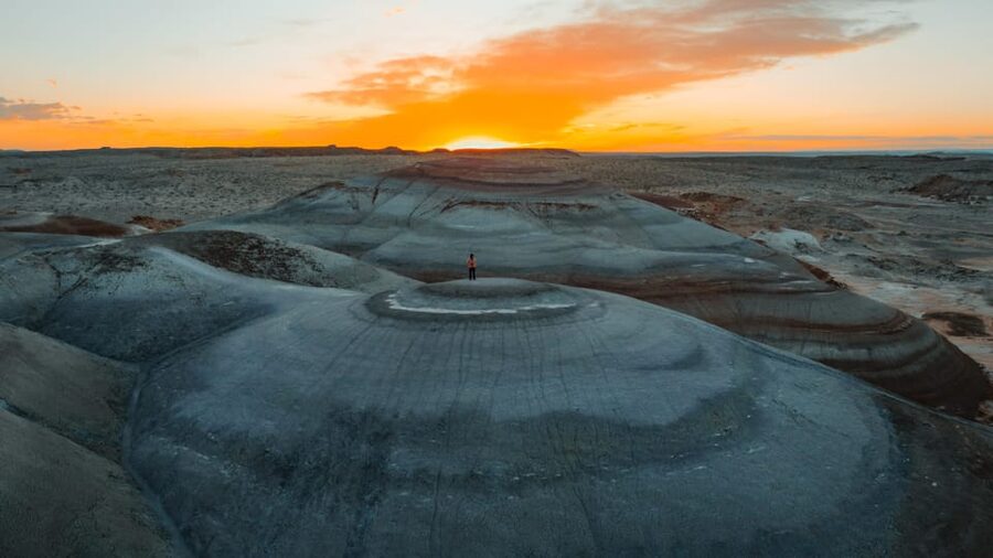
Aerial views make particular sense here. From above, the clay ridges form lines and swirls that can be difficult to see from ground level. Drone video footage is available as an add-on, and the results can show the scale and unusual geometry of the hills.
The tour price does not include a DJI Mini 4. That drone is available to rent, so you need to arrange the rental separately if you want to fly that model. The supplied information does not specify the add-on price, flight rules, or how much edited footage you receive, so ask for those details before booking.
I would also confirm exactly what the drone package includes. There is a difference between a short set of aerial clips, edited video, and raw files. That distinction matters if you are booking mainly for a finished travel film.
Drone use can also depend on current conditions and local rules. Since the tour takes place near a NASA research facility, ask the provider about approved flight areas and any restrictions before you arrive. Do not assume that every open-looking ridge is available for takeoff.
If you are not interested in aerial images, you can still enjoy the outing. The guide, vehicle access, and ground-level photo stops are the core of the experience.
What guides Jenny and Mel add
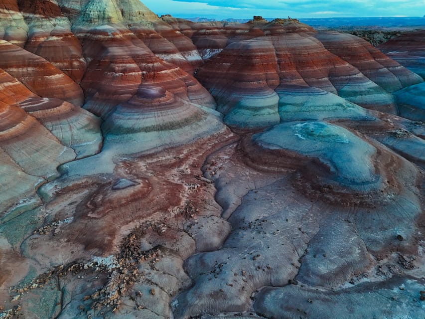
Jenny is the guide name most closely associated with the strongest praise. Her value is not just driving people to colorful hills. She has been praised for finding less obvious bentonite spots, explaining local geology, and making the visit feel personal.
That matters in a place where a casual stop can become repetitive. A guide who knows the area can help you notice why one ridge is worth photographing and another is less useful. Jenny has also offered suggestions for other things to do in the region, which can help you shape the rest of a southern Utah trip.
Mel has also helped with local planning, including advice and directions for other area activities. That kind of practical help is especially useful in Hanksville and the surrounding communities, where distances are long and services are limited.
Guiding is available in English, Russian, and Italian. If language is important to your booking, confirm your preferred guide and language in advance. The information confirms those languages but does not promise that every language is available at every departure.
Is $180 per person good value?
At $180 per person, this is a premium half-day outing. You are paying for more than a viewpoint: the price covers pickup, drop-off, off-road transportation, a live guide, water, and a private group.
The value is strongest if you do not have a suitable vehicle, you want help locating the most photogenic formations, or you plan to add drone footage. It is also useful if you want local context instead of driving out alone, taking a few pictures, and leaving without understanding the clay.
The value is weaker if you already know the area, have a capable off-road vehicle, and only want a quick roadside stop. The tour also asks you to pay for guidance and access even though the three-hour duration includes transportation and walking time.
For photographers, the private setup improves the calculation. You have a better chance to work at your own pace, and you avoid spending the outing waiting for a large group. For casual sightseers, the price may feel high unless the Mars-like scenery is a major reason for visiting Hanksville.
The perfect score from 12 ratings is encouraging, and the praise is consistent around scenery, guides, geology, and photo opportunities. Still, a small number of ratings cannot answer every question about seasonal conditions or long-term consistency. I would treat the strong score as a positive signal, then make your decision based on fitness, photography goals, and weather flexibility.
Weather can change the plan
The tour operates in a setting where weather and ground conditions matter. Rain can affect clay roads and walking surfaces, while heat and wind can change how comfortable the hills feel. The provider may modify, reschedule, or cancel the outing when conditions are unsuitable.
The provider makes the final call about weather, even if an app or park website suggests that conditions look acceptable. That policy may feel strict, but the guide is responsible for the actual route, road surface, and safety of the group.
I would avoid scheduling this as the one fixed activity that controls your entire trip. Leave room to move it to another day if possible. The reserve-now, pay-later option also helps keep your plans flexible, and cancellations made at least 24 hours in advance qualify for a full refund.
Who should book this Bentonite Hills tour?
I would recommend it most strongly to photographers, geology fans, visitors without off-road vehicles, and anyone who wants a private introduction to the Hanksville area. It is also a good choice if you want to add an unusual stop to a Capitol Reef itinerary based in Torrey or Teasdale.
You should think twice if you dislike rough vehicle rides, have trouble walking uphill, or want a fully accessible sightseeing experience. The 50 to 100 foot climb is not optional if you want the finest viewpoints.
This also is not the right outing for someone seeking a long, formal lesson in camera technique. You will get a guide, local explanations, and time to shoot, but the focus is the place itself.
FAQ
How long does the Bentonite Hills tour last?
The tour lasts three hours, including transportation and time at the Bentonite Hills photo locations.
How much does the tour cost?
The listed price is $180 per person.
Where is pickup available?
Complimentary pickup and drop-off are available in Hanksville, Torrey, and Teasdale. Look for a black or white SUV with Meridian lettering.
Is the tour private?
Yes. The tour is offered for a private group rather than a shared large group.
What languages are available?
Live guiding is available in English, Russian, and Italian.
Do I need to bring a drone?
No. A drone is not required. Drone video footage is available as an add-on, and a DJI Mini 4 can be rented separately. The drone is not included in the tour price.
Is the tour suitable for people with mobility limitations?
No. The tour is not suitable for people with mobility impairments, people over 60, or people with a low level of fitness. Reaching the best viewpoints requires climbing approximately 50 to 100 feet over uneven terrain.
Should you book it?
Book this tour if the Bentonite Hills are a main reason you want to visit Hanksville, and you value private transportation, local guidance, and strong photo access. Jenny’s geology explanations and knowledge of less obvious locations can turn a quick scenic stop into a more rewarding visit.
Skip it if you need an accessible outing, cannot handle uneven ground, or prefer to explore independently. For everyone else, $180 is reasonable when you use the private group, pickup, off-road access, and photography time. Keep a weather backup plan, wear closed-toe shoes, and ask clear questions about the drone add-on before paying.
More Drone Photography in the USA
- From Bangkok: Pattaya Island Trip with Drone Photos
★ 4.3 · 292 reviews - Clear Kayak Drone Photo Shoot and Video in Montego Bay
★ 5.0 · 275 reviews - Clear Kayaks Drone Photoshoot in Nassau,Bahamas.
★ 5.0 · 141 reviews - Clear Kayak Drone Photoshoot in Nassau Bahamas
★ 4.5 · 137 reviews
Just added around the USA
- Instagram tour of New York with a private photographer★ 4.0 · 5 reviews
- Las Vegas: Haunted House Wedding Ceremony + Photography★ 5.0 · 3 reviews
- Half-Day RMNP Lakes and Meadows Tour-RMNPhotographer★ 4.9 · 13 reviews
- Half-Day RMNP Mountains to Sky Tour-RMNPhotographer★ 5.0 · 3 reviews
- Las Vegas: Game of The Wedding Rings Ceremony + Photography★ 5.0 · 2 reviews
- Full-Day RMNP Over the Top Tour – RMNPhotographer★ 5.0 · 9 reviews
- From Kanab: 3-Hour Peek-a-Boo Slot Canyon Hiking/Photo Tour★ 4.9 · 25 reviews
- Everglades: Birding, Wildlife, and Photography Expedition★ 4.6 · 38 reviews
Drone Photography, compared.


Clear Kayak Drone Photo Shoot and Video in Montego Bay
Read our review →
Clear Kayaks Drone Photoshoot in Nassau,Bahamas.
Read our review →
Clear Kayak Drone Photoshoot in Nassau Bahamas
Read our review →

Drone Clear Kayak Barbados Photoshoot Experience
Read our review →
Aruba Unique Clear Kayak Drone Photoshoot with Video
Read our review →Browse the lists this shoot appears in